This blog summarises the recent launch of a new service offer by LDN Collective members PJA & Delta Simons (part of Lucion Group)
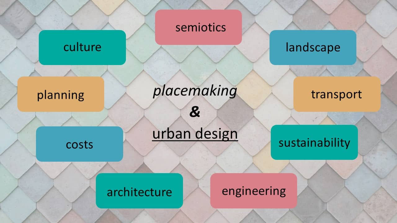
In urban development, Geographic Information Systems (GIS) are my go-to tools, guiding strategic decisions and shaping sustainable futures. I’m Ben Blowers from Delta Simons, and alongside Brian Norman from PJA, we are offering practical insights into harnessing GIS for various aspects of urban planning and development.

GIS integrates geographical data for actionable insights in urban development. It serves as a comprehensive digital platform, facilitating sophisticated site analysis, policy formulation, and infrastructure planning. GIS’s versatility extends beyond traditional boundary plans, empowering planners to make informed decisions across diverse urban contexts.
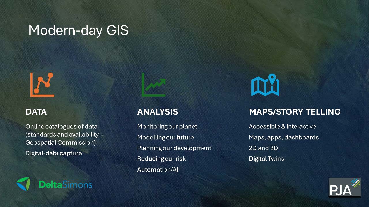
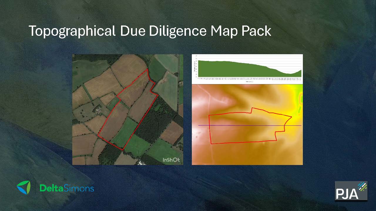
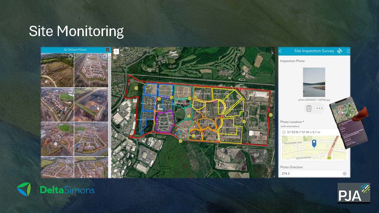
Data serves as the backbone of GIS applications, sourced from various channels like mobile GIS, drones, and satellite imagery. Robust data infrastructure ensures reliability and accuracy, essential for effective urban planning. By harnessing diverse data sources, GIS enables comprehensive analysis, supporting evidence-based decision-making processes.
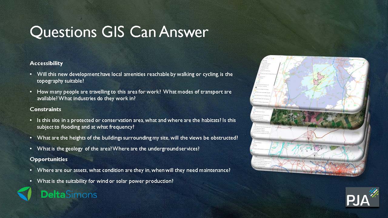
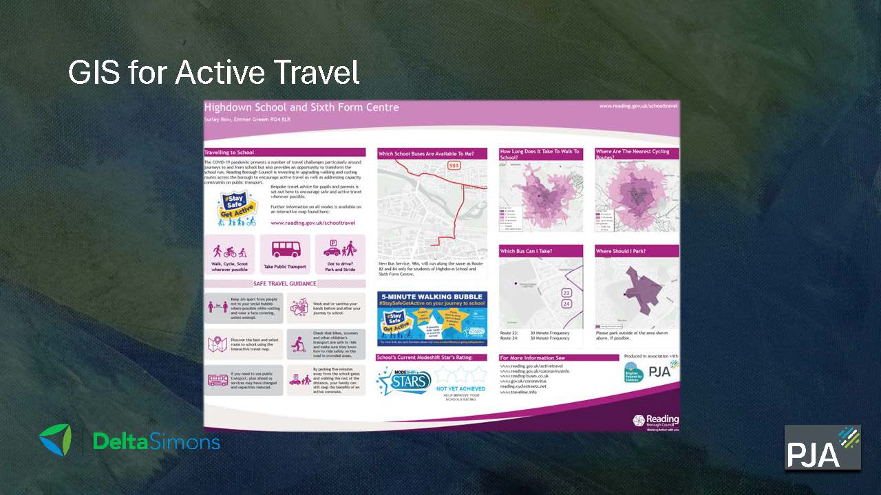
GIS plays a pivotal role in urban planning endeavours, addressing multifaceted challenges inherent in city management. From land use planning to transportation optimization, GIS offers valuable insights into urban dynamics. By integrating spatial data with demographic and socioeconomic indicators, planners can identify areas for growth, allocate resources efficiently, and enhance overall urban livability.
The integration of artificial intelligence (AI) with GIS represents a significant advancement in urban development. AI algorithms enhance GIS capabilities, enabling predictive modelling, pattern recognition, and scenario planning. This synergy facilitates proactive interventions, such as predictive maintenance of infrastructure and real-time risk assessment, contributing to resilient and sustainable cities.
Securing funding for GIS projects is essential for driving innovation and progress in urban development. Strategic partnerships and collaborative initiatives are crucial in accessing resources and expertise. By advocating for the value of GIS in addressing urban challenges, stakeholders can mobilize support for innovative projects and initiatives that benefit communities.
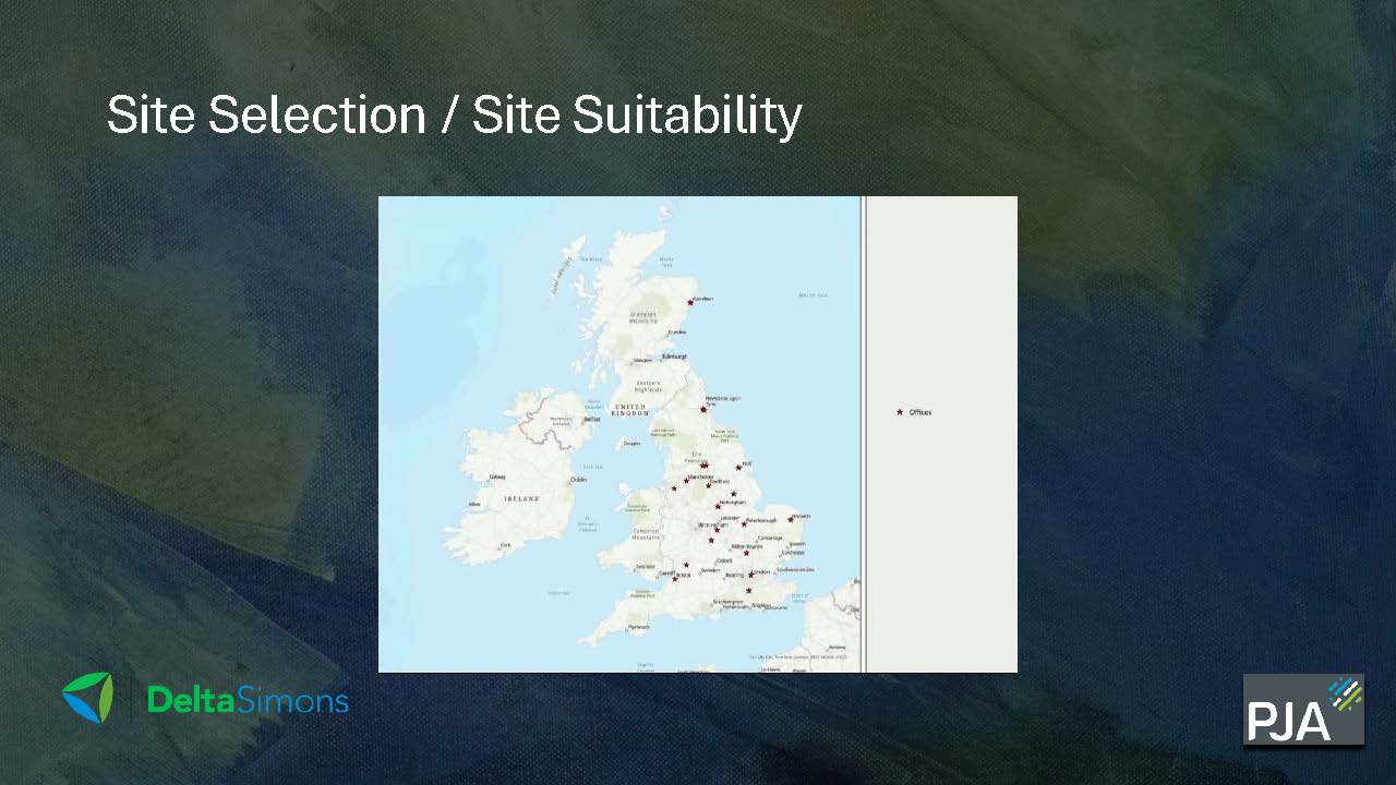
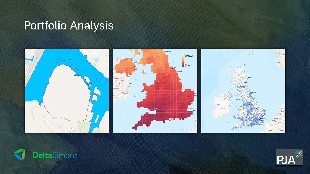
Real-world case studies demonstrate GIS’s efficacy in addressing diverse urban challenges. From flood risk assessment to urban regeneration, GIS applications have transformative impacts on urban landscapes. By showcasing successful projects and best practices, practitioners can inspire new approaches and solutions in urban development.
Looking ahead, GIS will continue to evolve as a cornerstone of urban development strategies. Emerging technologies, such as cloud computing and augmented reality, will further enhance GIS capabilities, unlocking new possibilities for smart and sustainable cities. Collaboration and knowledge exchange will be key in harnessing GIS’s full potential and driving positive change in urban environments.
In conclusion, GIS remains indispensable in navigating the complexities of urban development. Its versatility, coupled with advancements in technology and data analytics, positions GIS as a powerful tool for creating resilient, liveable, and inclusive cities. By leveraging GIS insights and fostering collaboration, we can shape urban environments that meet the needs of present and future generations.